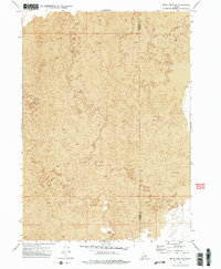
1972 Map of Bear Park SW
USGS Topo · Published 1976About this map
Lava flows dominate this stark corner of Idaho, creating an intricate landscape of volcanic features recorded during a 1971 aerial survey. The map document is defined almost entirely by these geological formations, illustrating the complex surface textures of the high desert. Stretching across the border of Minidoka Co and Blaine Co, the terrain offers a detailed study for those researching the natural history of the Snake River Plain before modern developments might have altered the visible topography. The lack of man-made structures or settlements highlights the isolation of this volcanic field during the early 1970s.
Find a feature on this map
2 named features on this map. Tap any name to fly to it.
Don’t see what you’re looking for? This feature index may not catch every label — zoom into the map to look around manually.
Map Details
Editions of this 1972 Bear Park SW Map
2 editions found
Other maps of this area

1954 · Pocatello
USGS Topo · 1:250,000

1955 · Idaho Falls
USGS Topo · 1:250,000

1958 · Idaho Falls
USGS Topo · 1:250,000

1958 · Pocatello
USGS Topo · 1:250,000

1972 · Bear Trap Cave
USGS Topo · 1:24,000

1972 · Mule Butte
USGS Topo · 1:24,000

1972 · Bear Park SW
USGS Topo · 1:24,000

1972 · Bear Den Butte
USGS Topo · 1:24,000

1972 · Bear Park East
USGS Topo · 1:24,000

1972 · Bottleneck Lake
USGS Topo · 1:24,000