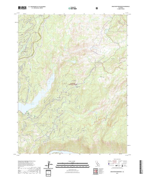
2021 Map of Bear River Reservoir
USGS Topo · Published 2021About this map
The Eldorado National Forest defines this high-elevation landscape, where the Bear River is harnessed for hydro-power and storage. The vast Bear River Reservoir and Lower Bear River Reservoir dominate the central terrain, while the northern edge of the Salt Springs Reservoir is visible in the south. This modern survey illustrates the complex water management infrastructure and recreational trail systems developed in the Sierra Nevada. High ridges like Anderson Ridge and Hungalelti Ridge provide natural boundaries for the deep drainages of Cole Cr and Tragedy Cr. Historical transportation corridors are represented by the Carson Emigrant N.R.T. Trl, reflecting the era of trans-Sierran migration. Localized clearings such as Foster Meadow, Onion Valley, and Willow Flat offer breaks in the dense forest, many connected by a web of 4WD tracks and forest service routes like S Bear River Rd.
Find a feature on this map
55 named features on this map. Tap any name to fly to it.
Don’t see what you’re looking for? This feature index may not catch every label — zoom into the map to look around manually.
Map Details
Editions of this 2021 Bear River Reservoir Map
This is the sole edition of this map. No revisions or reprints were ever made.
Other maps of this area

1889 · Pyramid Peak
USGS Topo · 1:125,000

1891 · Big Trees
USGS Topo · 1:125,000

1891 · Pyramid Peak
USGS Topo · 1:125,000

1894 · Big Trees
USGS Topo · 1:125,000

1895 · Pyramid Peak
USGS Topo · 1:125,000

1896 · Pyramid Peak
USGS Topo · 1:125,000

1897 · Big Trees
USGS Topo · 1:125,000

1901 · Big Trees
USGS Topo · 1:125,000

1947 · Sacramento
USGS Topo · 1:250,000

1948 · Sacramento
USGS Topo · 1:250,000