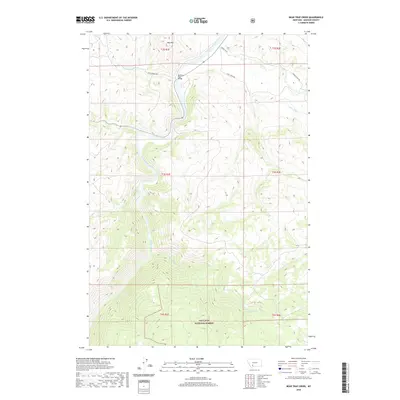
2020 Map of Bear Trap Creek
USGS Topo · Published 2020About this map
Madison River carves a deep, winding path through this portion of Madison County, serving as the primary geographic corridor for a landscape defined by sharp elevation changes and significant water features. The rugged terrain rises toward the summit of Red Mtn in the north, while the southern reaches of the map are protected within the boundaries of the Gallatin National Forest. This 2020 survey documents a network of named drainages including Bear Trap Cr, Hot Springs Cr, and Cherry Cr, which feed the river from the surrounding uplands.
Find a feature on this map
21 named features on this map. Tap any name to fly to it.
Don’t see what you’re looking for? This feature index may not catch every label — zoom into the map to look around manually.
Map Details
Editions of this 2020 Bear Trap Creek Map
This is the sole edition of this map. No revisions or reprints were ever made.
Other maps of this area

1888 · Three Forks
USGS Topo · 1:250,000

1894 · Three Forks
USGS Topo · 1:250,000

1895 · Three Forks
USGS Topo · 1:250,000

1947 · Bozeman
USGS Topo · 1:250,000

1948 · Bozeman
USGS Topo · 1:250,000

1949 · Anceney
USGS Topo · 1:62,500

1949 · Ennis
USGS Topo · 1:62,500

1949 · Norris
USGS Topo · 1:62,500

1950 · Spanish Peaks
USGS Topo · 1:62,500

1951 · Norris
USGS Topo · 1:62,500