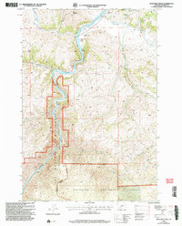
2000 Map of Bear Trap Creek
USGS Topo · Published 2005About this map
Madison River carves a deep path through this Madison County landscape, dominated by the protected expanses of the Lee Metcalf Wilderness (Bear Trap Canyon Unit) and the Gallatin National Forest. The map documents a rugged terrain defined by sharp elevation shifts, from the heights of Red Mountain and Savannah down to the winding river banks. Historically, the area shows signs of resource exploration, indicated by numerous Prospects, Mine Shafts, and an Adit scattered across the ridges.
Find a feature on this map
23 named features on this map. Tap any name to fly to it.
Don’t see what you’re looking for? This feature index may not catch every label — zoom into the map to look around manually.
Map Details
Editions of this 2000 Bear Trap Creek Map
This is the sole edition of this map. No revisions or reprints were ever made.
Other maps of this area

1888 · Three Forks
USGS Topo · 1:250,000

1894 · Three Forks
USGS Topo · 1:250,000

1895 · Three Forks
USGS Topo · 1:250,000

1947 · Bozeman
USGS Topo · 1:250,000

1948 · Bozeman
USGS Topo · 1:250,000

1949 · Anceney
USGS Topo · 1:62,500

1949 · Ennis
USGS Topo · 1:62,500

1949 · Norris
USGS Topo · 1:62,500

1950 · Spanish Peaks
USGS Topo · 1:62,500

1951 · Norris
USGS Topo · 1:62,500