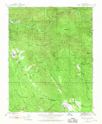
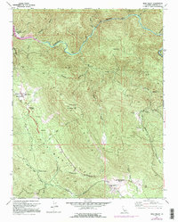
1947 Map of Bear Valley
USGS Topo · Published 1968About this map
Mount Bullion and the surrounding gold-rich slopes of the Mother Lode dominate this mid-century topographic record of Mariposa County. The landscape is defined by its deep mining history, with operations like the Pine Tree Mine, French Mine, and Josephine Mine clustered near the Merced River. Further south, the settlement of Bear Valley serves as a local hub, featuring the Bear Valley Sch and a dedicated Bear Valley Sub-Station.
Find a feature on this map
44 named features on this map. Tap any name to fly to it.
Don’t see what you’re looking for? This feature index may not catch every label — zoom into the map to look around manually.
Map Details
Editions of this 1947 Bear Valley Map
5 editions found
Other maps of this area

1893 · Sonora
USGS Topo · 1:125,000

1896 · Sonora
USGS Topo · 1:125,000

1897 · Sonora
USGS Topo · 1:125,000

1897 · Yosemite
USGS Topo · 1:125,000

1898 · Sonora
USGS Topo · 1:125,000

1900 · Yosemite
USGS Topo · 1:125,000

1903 · Yosemite
USGS Topo · 1:125,000

1909 · Yosemite
USGS Topo · 1:125,000

1912 · Mariposa
USGS Topo · 1:125,000

1919 · Indian Gulch
USGS Topo · 1:48,000