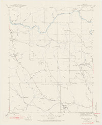
1947 Map of Bear Valley
USGS Topo · Published 1968About this map
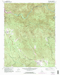
Bear Valley sits at the heart of this post-war landscape, a region deeply defined by its mining heritage and the rugged drainage of the Merced River. The map reveals a dense concentration of mineral extraction sites along the hillsides, including the Pine Tree Mine, Josephine Mine, and the Mountain King Mine (Abandoned). These workings, alongside smaller prospects like the Golden Key Mine and Diltz Mine, speak to the enduring geological draw of the Mother Lode.
Find a feature on this map
40 named features on this map. Tap any name to fly to it.
Don’t see what you’re looking for? This feature index may not catch every label — zoom into the map to look around manually.
Map Details
Editions of this 1947 Bear Valley Map
5 editions found
Other maps of this area

1893 · Sonora
USGS Topo · 1:125,000

1896 · Sonora
USGS Topo · 1:125,000

1897 · Sonora
USGS Topo · 1:125,000

1897 · Yosemite
USGS Topo · 1:125,000

1898 · Sonora
USGS Topo · 1:125,000

1900 · Yosemite
USGS Topo · 1:125,000

1903 · Yosemite
USGS Topo · 1:125,000

1909 · Yosemite
USGS Topo · 1:125,000

1912 · Mariposa
USGS Topo · 1:125,000

1919 · Indian Gulch
USGS Topo · 1:48,000