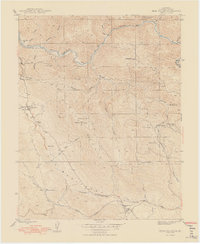
1948 Map of Bear Valley
USGS Topo · Published 1948About this map
Bullion Mountains and the gold-rich canyons of the Merced River define this post-war landscape in the Sierra foothills. The region is heavily marked by its mining legacy, featuring an extensive network of claims including the Pine Tree Mine, Josephine Mine, and the Mountain King Mine (Abandoned) along the northern river bends. Settlement is clustered around the historic community of Bear Valley and its Bear Valley Sch, while smaller enclaves like Trabucco Gardens and Pendola Gardens occupy the lower gulches. The infrastructure of the late 1940s is evident in the inclusion of the Mariposa Airport and an Airway Beacon, showing the transition from a nineteenth-century mining economy to a modern transportation corridor along State Route 49.
Find a feature on this map
43 named features on this map. Tap any name to fly to it.
Don’t see what you’re looking for? This feature index may not catch every label — zoom into the map to look around manually.
Map Details
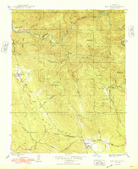
Editions of this 1948 Bear Valley Map
2 editions found
Other maps of this area

1893 · Sonora
USGS Topo · 1:125,000

1896 · Sonora
USGS Topo · 1:125,000

1897 · Sonora
USGS Topo · 1:125,000

1897 · Yosemite
USGS Topo · 1:125,000

1898 · Sonora
USGS Topo · 1:125,000

1900 · Yosemite
USGS Topo · 1:125,000

1903 · Yosemite
USGS Topo · 1:125,000

1909 · Yosemite
USGS Topo · 1:125,000

1912 · Mariposa
USGS Topo · 1:125,000

1919 · Indian Gulch
USGS Topo · 1:48,000