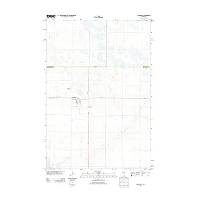
2013 Map of Beardsley
USGS Topo · Published 2013About this map
Beardsley serves as the central hub of this agricultural landscape in Big Stone County, situated just north of the Minnesota River Big Stone Lake. The town is organized around a traditional grid featuring Keystone Ave and a local Po, acting as a crossroads for MN-28 and MN-7. The surrounding terrain is marked by the meandering path of Fish Cr and several glacial depressions that dot the northern section of the map. Genealogists will find significant value in the documentation of local burial sites, including Saint Mary Cem to the south and both Beardsley Cem and Midway Cem on the western outskirts. The boundary between Traverse Co and Big Stone Co is clearly delineated along Co Hwy-3, illustrating the administrative borders that define this corner of western Minnesota.
Find a feature on this map
19 named features on this map. Tap any name to fly to it.
Don’t see what you’re looking for? This feature index may not catch every label — zoom into the map to look around manually.
Map Details
Editions of this 2013 Beardsley Map
This is the sole edition of this map. No revisions or reprints were ever made.
Other maps of this area

1916 · Peever
USGS Topo · 1:62,500

1916 · Beardsley
USGS Topo · 1:62,500

1918 · Peever
USGS Topo · 1:62,500

1918 · Beardsley
USGS Topo · 1:62,500

1953 · Milbank
USGS Topo · 1:250,000

1954 · Big Stone Lake
USGS Topo · 1:62,500

1958 · Milbank
USGS Topo · 1:250,000

1971 · Big Stone Lake East
USGS Topo · 1:24,000

1971 · Browns Valley
USGS Topo · 1:24,000

1971 · Big Stone Lake West
USGS Topo · 1:24,000