
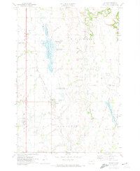
1971 Map of Browns Valley
USGS Topo · Published 1974About this map
Browns Valley sits at a narrow continental divide between the northward-flowing Lake Traverse and the southward-flowing Big Stone Lake. This 1970s survey captures the region's transport and conservation footprint, showing the Burlington Northern railroad corridor cutting through the valley floor alongside the Little Minnesota River. The map highlights a landscape of essential rural infrastructure, from the Townhall and local Gaging Station to numerous gravel pits supporting local works. Conservation areas are prominent, including the Eastman State Wildlife Management Area and the marshy reaches of Eastman Slough. Genealogists and local historians can locate the Valley View Cem and a smaller Cem northwest of town, providing a clear spatial record of the community's civic and residential layout during this era of Minnesota and South Dakota border history.
Find a feature on this map
29 named features on this map. Tap any name to fly to it.
Don’t see what you’re looking for? This feature index may not catch every label — zoom into the map to look around manually.
Map Details
Editions of this 1971 Browns Valley Map
This is the sole edition of this map. No revisions or reprints were ever made.
Other maps of this area

1916 · Peever
USGS Topo · 1:62,500

1916 · Beardsley
USGS Topo · 1:62,500

1918 · Peever
USGS Topo · 1:62,500

1918 · Beardsley
USGS Topo · 1:62,500

1953 · Milbank
USGS Topo · 1:250,000

1954 · Big Stone Lake
USGS Topo · 1:62,500

1958 · Milbank
USGS Topo · 1:250,000

1970 · Wilmot NW
USGS Topo · 1:24,000
1971 · Peever
USGS Topo · 1:24,000

1971 · Big Stone Lake West
USGS Topo · 1:24,000
Featured Places
- Browns Valley, MN
- Lake Traverse District, SD
- Big Stone County, MN
- Traverse County, MN
- Roberts County, SD