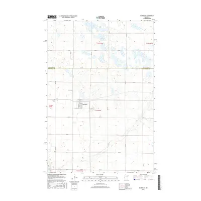
2016 Map of Beardsley
USGS Topo · Published 2016About this map
The town of Beardsley serves as a central hub on this landscape, positioned along the border where Big Stone County meets Traverse County. The community's grid is detailed with residential and commercial streets including Main St S, Windom Ave, and Railroad Ave, reflecting its history as a prairie rail town. Local genealogy is well-served by several burial grounds, including the Beardsley Cem, Midway Cem, and Saint Mary Cem, the latter of which is located just southeast of the town center.
Find a feature on this map
47 named features on this map. Tap any name to fly to it.
Don’t see what you’re looking for? This feature index may not catch every label — zoom into the map to look around manually.
Map Details
Editions of this 2016 Beardsley Map
This is the sole edition of this map. No revisions or reprints were ever made.
Other maps of this area

1916 · Peever
USGS Topo · 1:62,500

1916 · Beardsley
USGS Topo · 1:62,500

1918 · Peever
USGS Topo · 1:62,500

1918 · Beardsley
USGS Topo · 1:62,500

1953 · Milbank
USGS Topo · 1:250,000

1954 · Big Stone Lake
USGS Topo · 1:62,500

1958 · Milbank
USGS Topo · 1:250,000

1971 · Big Stone Lake East
USGS Topo · 1:24,000

1971 · Browns Valley
USGS Topo · 1:24,000

1971 · Big Stone Lake West
USGS Topo · 1:24,000