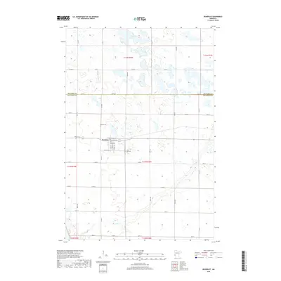
2019 Map of Beardsley
USGS Topo · Published 2019About this map
Beardsley serves as the central hub of this agricultural landscape in Big Stone County, straddling the county line with Traverse County. The town's grid is anchored by Main St S and Windom Ave, with the former railroad corridor marked by Railroad Ave. Outside the town center, the terrain is characterized by a high density of wetlands and depressions typical of the region, including Flood Slough and Wet Lake to the north, and the meandering course of Fish Cr to the south.
Find a feature on this map
46 named features on this map. Tap any name to fly to it.
Don’t see what you’re looking for? This feature index may not catch every label — zoom into the map to look around manually.
Map Details
Editions of this 2019 Beardsley Map
This is the sole edition of this map. No revisions or reprints were ever made.
Other maps of this area

1916 · Peever
USGS Topo · 1:62,500

1916 · Beardsley
USGS Topo · 1:62,500

1918 · Peever
USGS Topo · 1:62,500

1918 · Beardsley
USGS Topo · 1:62,500

1953 · Milbank
USGS Topo · 1:250,000

1954 · Big Stone Lake
USGS Topo · 1:62,500

1958 · Milbank
USGS Topo · 1:250,000

1971 · Big Stone Lake East
USGS Topo · 1:24,000

1971 · Browns Valley
USGS Topo · 1:24,000

1971 · Big Stone Lake West
USGS Topo · 1:24,000