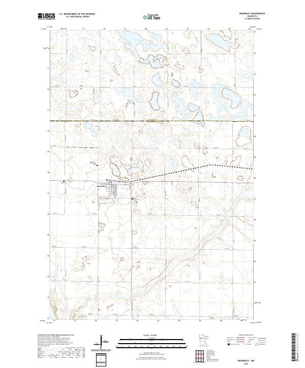
2022 Map of Beardsley
USGS Topo · Published 2022About this map
Beardsley sits at the intersection of local history and a watery landscape, serving as a hub for the surrounding agricultural community of Big Stone Co and Traverse Co. The village layout is intricately detailed, showing its core street grid from Railroad Ave down through Main St S and Westfall St S. This modern topographic perspective reveals how the town is physically anchored by its spiritual and communal sites, including the Beardsley Community Cem, Midway Cem, and Saint Mary Cem located on the town's periphery.
Find a feature on this map
45 named features on this map. Tap any name to fly to it.
Don’t see what you’re looking for? This feature index may not catch every label — zoom into the map to look around manually.
Map Details
Editions of this 2022 Beardsley Map
This is the sole edition of this map. No revisions or reprints were ever made.
Other maps of this area

1916 · Peever
USGS Topo · 1:62,500

1916 · Beardsley
USGS Topo · 1:62,500

1918 · Peever
USGS Topo · 1:62,500

1918 · Beardsley
USGS Topo · 1:62,500

1953 · Milbank
USGS Topo · 1:250,000

1954 · Big Stone Lake
USGS Topo · 1:62,500

1958 · Milbank
USGS Topo · 1:250,000

1971 · Big Stone Lake East
USGS Topo · 1:24,000

1971 · Browns Valley
USGS Topo · 1:24,000

1971 · Big Stone Lake West
USGS Topo · 1:24,000