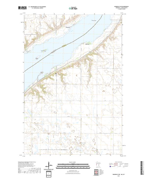
2022 Map of Beardsley NW
USGS Topo · Published 2022About this map
Lake Traverse defines the landscape of this border region, carving a wide valley along the state line between South Dakota and Minnesota. The map documents the northern reaches of this long, narrow reservoir, identifying distinctive landforms like Skunk Island, Carlson Island, and Jackson Island. Inland from the eastern shore, the terrain rises into the rolling agricultural lands of Traverse County, where the small community of Dakomin and the high point of Diamond sit above the water. A rural network of roads, including Co Hwy 3 and Co Hwy 4, connects the scattered farmsteads of the prairie. Local history is anchored by the Lake View Cem, situated on a bluff overlooking the water near Rainbow Island, illustrating the long-standing connection between the settled uplands and the lake's edge.
Find a feature on this map
41 named features on this map. Tap any name to fly to it.
Don’t see what you’re looking for? This feature index may not catch every label — zoom into the map to look around manually.
Map Details
Editions of this 2022 Beardsley NW Map
This is the sole edition of this map. No revisions or reprints were ever made.
Other maps of this area

1915 · White Rock
USGS Topo · 1:62,500

1916 · Peever
USGS Topo · 1:62,500

1916 · Beardsley
USGS Topo · 1:62,500

1917 · New Effington
USGS Topo · 1:62,500

1918 · Peever
USGS Topo · 1:62,500

1918 · White Rock
USGS Topo · 1:62,500

1918 · Beardsley
USGS Topo · 1:62,500

1953 · Milbank
USGS Topo · 1:250,000

1958 · Milbank
USGS Topo · 1:250,000

1971 · Browns Valley
USGS Topo · 1:24,000