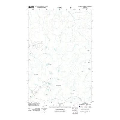
2011 Map of Bearhead Mountain
USGS Topo · Published 2011About this map
Bearhead Mountain and Cayada Mountain anchor this high-elevation landscape, where the headwaters of the Clearwater River and Milky Creek cut through deep drainage basins. This area is defined by its mining history, evidenced by the Copper King Mine, Queen Bee Mine, and Clipper Mine situated near the south-central peaks. The terrain is dotted with high lakes, including Summit Lake, Coplay Lake, and Cedar Lake, while navigational points like Martin Gap and Hurricane Gap provide passage through the steep topography.
Find a feature on this map
40 named features on this map. Tap any name to fly to it.
Don’t see what you’re looking for? This feature index may not catch every label — zoom into the map to look around manually.
Map Details
Editions of this 2011 Bearhead Mountain Map
This is the sole edition of this map. No revisions or reprints were ever made.
Other maps of this area

1913 · Cedar Lake
USGS Topo · 1:125,000

1924 · Mt Rainier
USGS Topo · 1:96,000

1928 · Mt Rainier
USGS Topo · 1:125,000

1950 · Yakima
USGS Topo · 1:250,000

1956 · Greenwater
USGS Topo · 1:62,500

1956 · Enumclaw
USGS Topo · 1:62,500
1956 · Enumclaw
USGS Topo · 1:24,000

1957 · Wenatchee
USGS Topo · 1:250,000

1958 · Yakima
USGS Topo · 1:250,000

1961 · Yakima
USGS Topo · 1:250,000