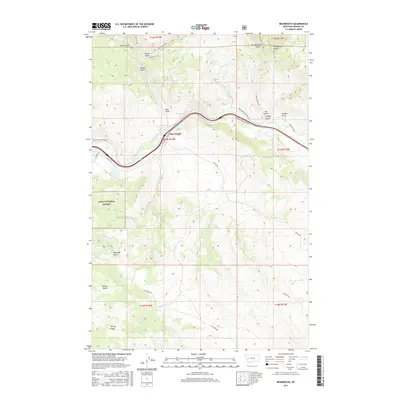
2017 Map of Bearmouth
USGS Topo · Published 2017About this map
Bearmouth occupies a strategic position along the Clark Fork river, where transportation corridors have carved through the Montana landscape for generations. This 2017 survey illustrates the modern alignment of Interstate 90 and the Bearmouth RR Access Rd alongside the historic path of Mullan Rd. The surrounding terrain is defined by a dense network of gulches, including Felan Gulch, Packer Gulch, and Snyder Gulch, which drain from the high ridges into the river valley. To the southwest, the Lolo National Forest boundary marks a transition into protected timberlands. Local infrastructure is anchored by ranching and access roads like Bear Gulch Rd and Cow Creek Rd, while features like Bearmouth Spring and Harvey Ridge provide specific landmarks for those studying the physical geography and land use of Granite County.
Find a feature on this map
39 named features on this map. Tap any name to fly to it.
Don’t see what you’re looking for? This feature index may not catch every label — zoom into the map to look around manually.
Map Details
Editions of this 2017 Bearmouth Map
This is the sole edition of this map. No revisions or reprints were ever made.
Other maps of this area

1919 · Drummond
USGS Topo · 1:125,000

1921 · Drummond
USGS Topo · 1:125,000

1947 · Butte
USGS Topo · 1:250,000

1958 · Butte
USGS Topo · 1:250,000

1958 · Drummond
USGS Topo · 1:62,500

1959 · Bearmouth
USGS Topo · 1:62,500

1960 · Butte
USGS Topo · 1:250,000

1962 · Butte
USGS Topo · 1:250,000

1965 · Union Peak
USGS Topo · 1:24,000

1965 · Wild Horse Parks
USGS Topo · 1:24,000