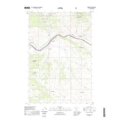
2020 Map of Bearmouth
USGS Topo · Published 2020About this map
Bearmouth occupies a strategic position along the Clark Fork river, where the valley floor meets the rising terrain of the Lolo National Forest. The landscape is defined by a dense network of gulches and ridges, including Harvey Ridge and the distinct drainages of Felan Gulch, Packer Gulch, and Snyder Gulch. Transport through this corridor is well-documented, showing the proximity of the historic Mullan Rd and various frontage routes that service the area's steep topography.
Find a feature on this map
41 named features on this map. Tap any name to fly to it.
Don’t see what you’re looking for? This feature index may not catch every label — zoom into the map to look around manually.
Map Details
Editions of this 2020 Bearmouth Map
This is the sole edition of this map. No revisions or reprints were ever made.
Other maps of this area

1919 · Drummond
USGS Topo · 1:125,000

1921 · Drummond
USGS Topo · 1:125,000

1947 · Butte
USGS Topo · 1:250,000

1958 · Butte
USGS Topo · 1:250,000

1958 · Drummond
USGS Topo · 1:62,500

1959 · Bearmouth
USGS Topo · 1:62,500

1960 · Butte
USGS Topo · 1:250,000

1962 · Butte
USGS Topo · 1:250,000

1965 · Union Peak
USGS Topo · 1:24,000

1965 · Wild Horse Parks
USGS Topo · 1:24,000