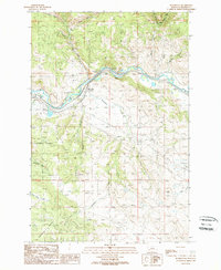
1989 Map of Bearmouth
USGS Topo · Published 1989About this map
The Clark Fork river valley serves as the central artery for this mountainous section of Montana, where the settlement of Bearmouth sits at the confluence of the river and Bear Creek. In the late 1980s, this landscape retained clear evidence of its mining history, with several prospects and areas of tailings scattered along the northern gulches, including Snyder Gulch and Packer Gulch. The southern portion of the map is dominated by the steep, rising terrain of Harvey Ridge, which falls within the boundaries of the Lolo National Forest.
Find a feature on this map
29 named features on this map. Tap any name to fly to it.
Don’t see what you’re looking for? This feature index may not catch every label — zoom into the map to look around manually.
Map Details
Editions of this 1989 Bearmouth Map
This is the sole edition of this map. No revisions or reprints were ever made.
Other maps of this area

1919 · Drummond
USGS Topo · 1:125,000

1921 · Drummond
USGS Topo · 1:125,000

1947 · Butte
USGS Topo · 1:250,000

1958 · Butte
USGS Topo · 1:250,000

1958 · Drummond
USGS Topo · 1:62,500

1959 · Bearmouth
USGS Topo · 1:62,500

1960 · Butte
USGS Topo · 1:250,000

1962 · Butte
USGS Topo · 1:250,000

1965 · Union Peak
USGS Topo · 1:24,000

1965 · Wild Horse Parks
USGS Topo · 1:24,000