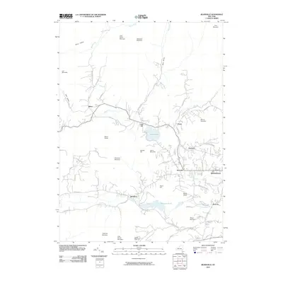
2010 Map of Bearsville
USGS Topo · Published 2010About this map
The mountain hamlet of Bearsville serves as a central hub in this upland landscape, where the Saw Kill and Beaver Kill waterways dictate the placement of early roads and settlements. To the east, the historic arts colony of Byrdcliffe sits on the slopes above Woodstock, while to the west, Lake Hill and Willow follow the winding path of Route 212. The presence of Cooper Lake and Yanketown Pond highlights the importance of water management in this part of Ulster County, with Mink Hollow and Silver Hollow providing natural corridors through the Catskill peaks. Peaks like Mount Guardian, Olderbark Mountain, and Mount Tobias surround these small communities, preserving a settlement pattern that remained remarkably stable into the early 21st century. Researchers can trace numerous family-named roads, such as Sickler Rd and Reynolds Ln, which connect the scattered residences and mountain farms that define the region's character.
Find a feature on this map
71 named features on this map. Tap any name to fly to it.
Don’t see what you’re looking for? This feature index may not catch every label — zoom into the map to look around manually.
Map Details
Editions of this 2010 Bearsville Map
This is the sole edition of this map. No revisions or reprints were ever made.
Other maps of this area

1892 · Kaaterskill
USGS Topo · 1:62,500

1893 · Kaaterskill
USGS Topo · 1:62,500

1894 · Kaaterskill
USGS Topo · 1:62,500

1899 · Kaaterskill
USGS Topo · 1:62,500

1900 · Phoenicia
USGS Topo · 1:62,500

1901 · Rosendale
USGS Topo · 1:62,500

1903 · Rosendale
USGS Topo · 1:62,500

1903 · Phoenicia
USGS Topo · 1:62,500

1903 · Kaaterskill
USGS Topo · 1:62,500

1903 · Slide Mountain
USGS Topo · 1:62,500