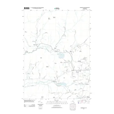
2013 Map of Bearsville
USGS Topo · Published 2013About this map
Bearsville and the surrounding Catskill foothills are defined by a network of winding roads and high peaks in this USGS study. The settlement of Byrdcliffe sits to the east of Mount Guardian, while to the west, Mount Tobias and Roundtop Mountain dominate the central terrain. The drainage patterns of the Saw Kill and Beaver Kill shape the valleys, connecting smaller hamlets like Shady, Lake Hill, and Willow. Water features such as Cooper Lake and Yanketown Pond provide clear reference points for those studying the regional geography near Wittenberg. This record documents the intricate road network of the early 21st century, from Silver Hollow Rd to Mink Hollow Rd, reflecting the persistent residential and agricultural layout of this pocket of Ulster County.
Find a feature on this map
122 named features on this map. Tap any name to fly to it.
Don’t see what you’re looking for? This feature index may not catch every label — zoom into the map to look around manually.
Map Details
Editions of this 2013 Bearsville Map
This is the sole edition of this map. No revisions or reprints were ever made.
Other maps of this area

1892 · Kaaterskill
USGS Topo · 1:62,500

1893 · Kaaterskill
USGS Topo · 1:62,500

1894 · Kaaterskill
USGS Topo · 1:62,500

1899 · Kaaterskill
USGS Topo · 1:62,500

1900 · Phoenicia
USGS Topo · 1:62,500

1901 · Rosendale
USGS Topo · 1:62,500

1903 · Rosendale
USGS Topo · 1:62,500

1903 · Phoenicia
USGS Topo · 1:62,500

1903 · Kaaterskill
USGS Topo · 1:62,500

1903 · Slide Mountain
USGS Topo · 1:62,500