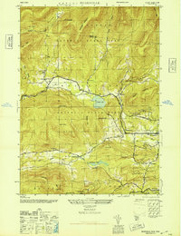
1946 Map of Bearsville
USGS Topo · Published 1946About this map
Woodstock and the surrounding hamlets of the Catskill High Peaks region are documented here in the mid-1940s, just as the area's reputation as a cultural and artistic retreat was firmly established. The map highlights the rugged topography of Hunter-Catskill State Park, where steep drainages like Silver Hollow and Mink Hollow descend from Olderbark Mountain and Twin Mtn. In the valleys, a network of small schoolhouses, including School No 5 and School No 3, serves scattered settlements like Shady and Lake Hill.
Find a feature on this map
43 named features on this map. Tap any name to fly to it.
Don’t see what you’re looking for? This feature index may not catch every label — zoom into the map to look around manually.
Map Details
Editions of this 1946 Bearsville Map
This is the sole edition of this map. No revisions or reprints were ever made.
Other maps of this area

1892 · Kaaterskill
USGS Topo · 1:62,500

1893 · Kaaterskill
USGS Topo · 1:62,500

1894 · Kaaterskill
USGS Topo · 1:62,500

1899 · Kaaterskill
USGS Topo · 1:62,500

1900 · Phoenicia
USGS Topo · 1:62,500

1901 · Rosendale
USGS Topo · 1:62,500

1903 · Rosendale
USGS Topo · 1:62,500

1903 · Phoenicia
USGS Topo · 1:62,500

1903 · Kaaterskill
USGS Topo · 1:62,500

1903 · Slide Mountain
USGS Topo · 1:62,500