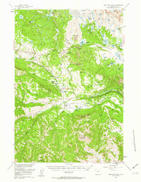
1956 Map of Beartooth Butte
USGS Topo · Published 1962About this map
Shoshone National Forest defines the character of this mid-century landscape, dominated by the massive profile of Beartooth Butte and the high Beartooth Plateau. The 1950s infrastructure reflects a balance between rugged wilderness management and growing alpine tourism, centered around the Beartooth Highway and the State Highway Maintenance Camp. High-altitude recreation is well-established at sites like Beartooth Lake Campground and Island Lake Campground, while the valleys of the Clarks Fork Yellowstone River and Crandall Creek support a network of remote family-named outposts. These include the L Bar T Ranch, Hunter Peak Ranch, and the Crandall Ranger Station. This survey documents a critical period of the High Rockies before modern expansion, capturing the placement of historical backcountry trails like Clarks Fork Trail and isolated landmarks such as Cathedral Cliffs and Windy Mountain.
Find a feature on this map
72 named features on this map. Tap any name to fly to it.
Don’t see what you’re looking for? This feature index may not catch every label — zoom into the map to look around manually.
Map Details
Editions of this 1956 Beartooth Butte Map
3 editions found

Other maps of this area

1896 · Crandall Creek
USGS Topo · 1:125,000

1898 · Granite Mountain District
USGS Topo · 1:125,000

1899 · Crandall
USGS Topo · 1:125,000

1949 · Pat O'Hara Mountain
USGS Topo · 1:62,500

1950 · Deep Lake
USGS Topo · 1:62,500

1954 · Billings
USGS Topo · 1:250,000

1955 · Cody
USGS Topo · 1:250,000

1956 · Alpine
USGS Topo · 1:62,500

1956 · Mount Maurice
USGS Topo · 1:62,500

1956 · Sunlight Peak
USGS Topo · 1:62,500