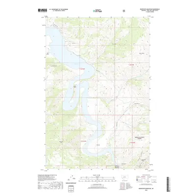
2020 Map of Beartooth Mountain
USGS Topo · Published 2020About this map
Holter Lake dominates the central corridor of this mountain landscape, following a winding path that creates distinctive geography like Oxbow Bend and Ming Bar. The map illustrates the convergence of high-altitude terrain and water management within the Helena National Forest. To the south, the Missouri River passage is famously marked by the Gates of the Rocky Mountains and the steep walls of Meriwether Canyon. Significant peaks such as Beartooth Mtn and Jackson Peak overlook the drainage basins of Beartooth Cr and Cottonwood Cr. The inclusion of Mann Gulch provides a specific point of interest for those studying regional geography and forest history. Limited access is noted via primitive routes like Beartooth Rd and Old Doc Rd, which navigate the complex ridges and gulches including Log Gulch and Negro Hollow.
Find a feature on this map
23 named features on this map. Tap any name to fly to it.
Don’t see what you’re looking for? This feature index may not catch every label — zoom into the map to look around manually.
Map Details
Editions of this 2020 Beartooth Mountain Map
This is the sole edition of this map. No revisions or reprints were ever made.
Other maps of this area

1886 · Great Falls
USGS Topo · 1:250,000

1886 · Fort Logan
USGS Topo · 1:250,000

1889 · Helena
USGS Topo · 1:250,000

1893 · Helena
USGS Topo · 1:250,000

1899 · Helena
USGS Topo · 1:250,000

1903 · Helena
USGS Topo · 1:250,000

1943 · Hogan
USGS Topo · 1:125,000

1947 · Butte
USGS Topo · 1:250,000

1948 · White Sulphur Springs
USGS Topo · 1:250,000

1954 · Great Falls
USGS Topo · 1:250,000