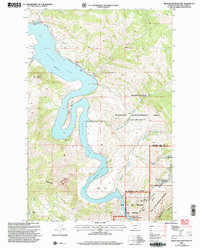
2001 Map of Beartooth Mountain
USGS Topo · Published 2004About this map
Holter Lake dominates this canyon landscape where the Missouri River cuts through the high country of Lewis and Clark County. The map documents a rugged transition between water and mountain, featuring the Gates of the Rocky Mountains and the steep terrain of Beartooth Mountain. Along the shoreline, recreational and specialized outposts like the Yacht Club, Oxbow Landing Strip, and Indian Trail Lodge show how the area was utilized at the turn of the 21st century.
Find a feature on this map
38 named features on this map. Tap any name to fly to it.
Don’t see what you’re looking for? This feature index may not catch every label — zoom into the map to look around manually.
Map Details
Editions of this 2001 Beartooth Mountain Map
This is the sole edition of this map. No revisions or reprints were ever made.
Other maps of this area

1886 · Great Falls
USGS Topo · 1:250,000

1886 · Fort Logan
USGS Topo · 1:250,000

1889 · Helena
USGS Topo · 1:250,000

1893 · Helena
USGS Topo · 1:250,000

1899 · Helena
USGS Topo · 1:250,000

1903 · Helena
USGS Topo · 1:250,000

1943 · Hogan
USGS Topo · 1:125,000

1947 · Butte
USGS Topo · 1:250,000

1948 · White Sulphur Springs
USGS Topo · 1:250,000

1954 · Great Falls
USGS Topo · 1:250,000