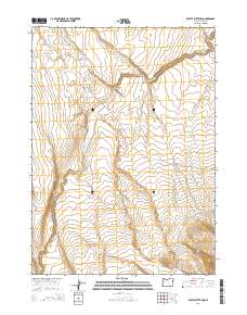
2014 Map of Beatys Butte NW
USGS Topo · Published 2014About this map
Lone Grave Butte and W Beaty Butte rise above the high desert floor of southeastern Oregon, marking a landscape defined by significant elevation changes and seasonal watercourses. This 2014 survey by the U.S. Geological Survey details the complex drainage patterns of Guano Slough, which winds through the central terrain towards Guano Canyon. The presence of Link Lake in the southwestern corner highlights the scattered water sources vital to this arid region. Geologic features like West Road Gulch and the deep incisions of Black Cyn reflect the erosional history of the volcanic plateau. This map provides an essential baseline for researchers tracking changes in public land use and watershed health within Lake County.
Find a feature on this map
14 named features on this map. Tap any name to fly to it.
Don’t see what you’re looking for? This feature index may not catch every label — zoom into the map to look around manually.
Map Details
Editions of this 2014 Beatys Butte NW Map
This is the sole edition of this map. No revisions or reprints were ever made.
Other maps of this area

1955 · Adel
USGS Topo · 1:250,000

1957 · Adel
USGS Topo · 1:250,000

1958 · Adel
USGS Topo · 1:250,000

1962 · Adel
USGS Topo · 1:250,000

1967 · Flook Lake
USGS Topo · 1:24,000

1967 · Alger Lake
USGS Topo · 1:24,000

1967 · Swede Knoll
USGS Topo · 1:24,000

1971 · Beatys Butte
USGS Topo · 1:24,000

1971 · Mahogany Butte
USGS Topo · 1:24,000

1971 · Murphy Waterholes
USGS Topo · 1:24,000