
1971 Map of Murphy Waterholes
USGS Topo · Published 1974About this map
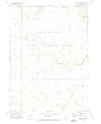
Hart Mountain National Antelope Refuge dominates the western portion of this high desert landscape, preserving a critical sanctuary for regional wildlife. The topography is defined by the Murphy Waterholes, a series of essential water sources scattered across the arid terrain. These features, along with Pistol Lake and several named sites like Westside Waterhole and Zero Waterhole, underscore the importance of water management for both wildlife and livestock in this environment. A network of primitive transport is visible via the Jeep Trail, which winds through the area toward landmarks such as the Murphy Corral. In the south, the terrain drops into Black Canyon, providing a stark contrast to the surrounding flats and buttes. This survey captures a moment when the land was primarily used for conservation and seasonal grazing before more modern developments reached this part of Lake County.
Find a feature on this map
10 named features on this map. Tap any name to fly to it.
Don’t see what you’re looking for? This feature index may not catch every label — zoom into the map to look around manually.
Map Details
Editions of this 1971 Murphy Waterholes Map
This is the sole edition of this map. No revisions or reprints were ever made.
Other maps of this area

1955 · Adel
USGS Topo · 1:250,000

1957 · Adel
USGS Topo · 1:250,000

1958 · Adel
USGS Topo · 1:250,000

1962 · Adel
USGS Topo · 1:250,000

1966 · Bluejoint Lake East
USGS Topo · 1:24,000

1967 · Flook Lake
USGS Topo · 1:24,000

1967 · Swede Knoll
USGS Topo · 1:24,000

1971 · Beatys Butte
USGS Topo · 1:24,000
1971 · Sixmile Draw
USGS Topo · 1:24,000
1971 · Guano Reservoir
USGS Topo · 1:24,000