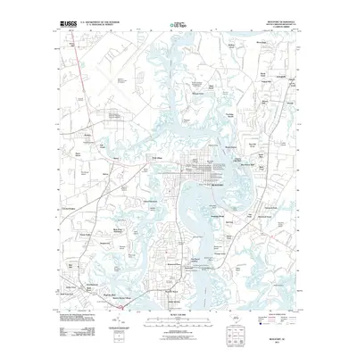
2011 Map of Beaufort
USGS Topo · Published 2011About this map
Beaufort and Port Royal define this Lowcountry landscape, where the Intracoastal Waterway and the Beaufort River weave through a network of islands and tidal creeks. The 2011 survey reveals a coastal community balancing its deep maritime heritage with significant institutional presence, from the expansive Beaufort Marine Corps Air Station to the University of South Carolina at Beaufort Campus. Residential growth is evident in developments like Waterford Place and Mariners Watch, yet the area's history remains anchored by several local landmarks. Genealogists will find numerous burial sites, including the Beaufort National Cemetery, Rose Hill Cemetery, and the Old Fort Cemetery. The map also captures the transition of old agrarian lands into modern settlements, noted by the presence of Salem Plantation and Mink Point Plantation, while marinas like Ladys Island Marina underscore the enduring importance of the waterfront economy.
Find a feature on this map
111 named features on this map. Tap any name to fly to it.
Don’t see what you’re looking for? This feature index may not catch every label — zoom into the map to look around manually.
Map Details
Editions of this 2011 Beaufort Map
This is the sole edition of this map. No revisions or reprints were ever made.
Other maps of this area

1918 · Green Pond
USGS Topo · 1:62,500

1918 · Yemassee
USGS Topo · 1:62,500

1920 · Okatie
USGS Topo · 1:62,500

1942 · Okatie
USGS Topo · 1:62,500

1943 · Yemassee
USGS Topo · 1:62,500

1943 · Green Pond
USGS Topo · 1:62,500

1944 · Fort Fremont
USGS Topo · 1:62,500

1947 · Savannah
USGS Topo · 1:250,000

1948 · Savannah
USGS Topo · 1:250,000

1956 · Frogmore
USGS Topo · 1:24,000