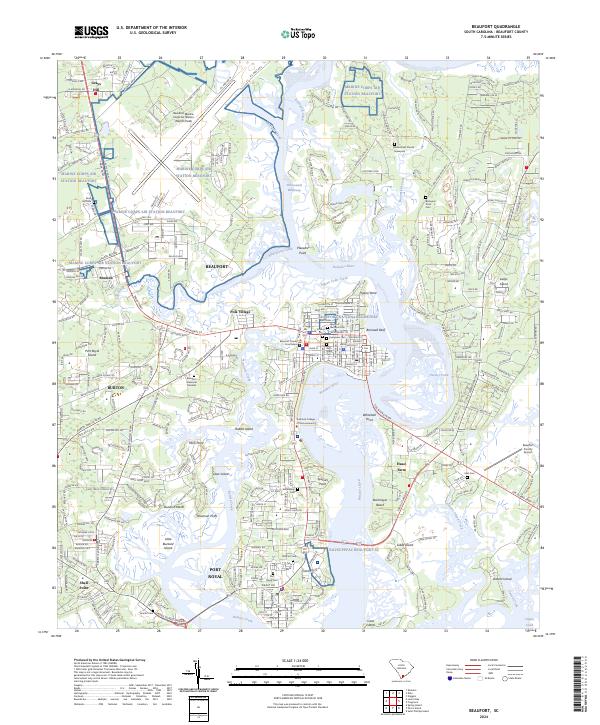
2024 Map of Beaufort
USGS Topo · Published 2024About this map
The Beaufort River and its intricate tidal tributaries define this South Carolina coastal landscape, anchoring a region deeply rooted in military history and civil rights heritage. The map highlights the extensive footprint of Marine Corps Air Station Beaufort to the north and the NAVSUPPFAC Beaufort SC near Port Royal. Central to the area's cultural significance is the Reconstruction Era National Monument, which preserves sites critical to the post-Civil War era.
Find a feature on this map
64 named features on this map. Tap any name to fly to it.
Don’t see what you’re looking for? This feature index may not catch every label — zoom into the map to look around manually.
Map Details
Editions of this 2024 Beaufort Map
This is the sole edition of this map. No revisions or reprints were ever made.
Other maps of this area

1918 · Green Pond
USGS Topo · 1:62,500

1918 · Yemassee
USGS Topo · 1:62,500

1920 · Okatie
USGS Topo · 1:62,500

1942 · Okatie
USGS Topo · 1:62,500

1943 · Yemassee
USGS Topo · 1:62,500

1943 · Green Pond
USGS Topo · 1:62,500

1944 · Fort Fremont
USGS Topo · 1:62,500

1947 · Savannah
USGS Topo · 1:250,000

1948 · Savannah
USGS Topo · 1:250,000

1956 · Frogmore
USGS Topo · 1:24,000