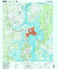
1998 Map of Beaufort
USGS Topo · Published 1999About this map
The coastal Lowcountry around Beaufort and Port Royal is defined by a complex network of saltwater passages and islands, including Ladies Island and Distant Island. This late-century survey documents the area's deep military and civic foundations, centered on the Marine Corps Air Station and the US Naval Reservation. Genealogists will find a high concentration of burial grounds and religious sites, such as the expansive Beaufort National Cemetery, Evergreen Cem, and Porter Chapel.
Find a feature on this map
71 named features on this map. Tap any name to fly to it.
Don’t see what you’re looking for? This feature index may not catch every label — zoom into the map to look around manually.
Map Details
Editions of this 1998 Beaufort Map
This is the sole edition of this map. No revisions or reprints were ever made.
Other maps of this area

1918 · Green Pond
USGS Topo · 1:62,500

1918 · Yemassee
USGS Topo · 1:62,500

1920 · Okatie
USGS Topo · 1:62,500

1942 · Okatie
USGS Topo · 1:62,500

1943 · Yemassee
USGS Topo · 1:62,500

1943 · Green Pond
USGS Topo · 1:62,500

1944 · Fort Fremont
USGS Topo · 1:62,500

1947 · Savannah
USGS Topo · 1:250,000

1948 · Savannah
USGS Topo · 1:250,000

1956 · Frogmore
USGS Topo · 1:24,000