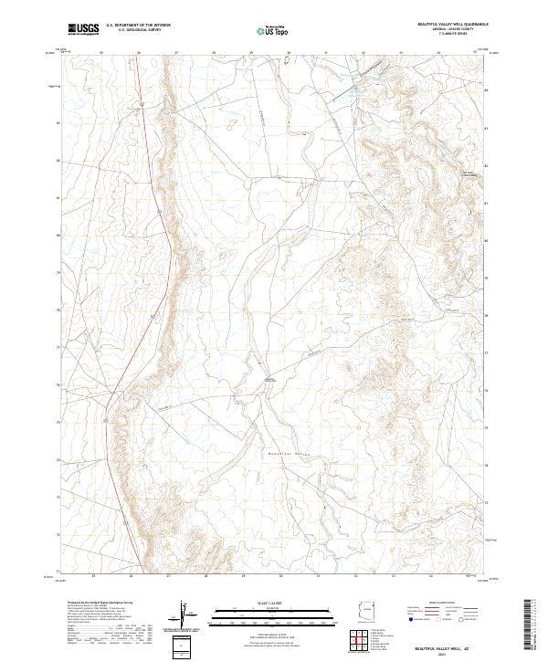
2021 Map of Beautiful Valley Well
USGS Topo · Published 2021About this map
Beautiful Valley provides the setting for this remote landscape, where seasonal watercourses like Nazlini Wash and Tah-aith-cheed Wash define the drainage of the high desert. The namesake Beautiful Valley Well sits near the center of the sheet, a vital resource for livestock and inhabitants in an area characterized by wide expanses and canyon systems like Cottonwood Canyon. In the northeast, Flat Rock Reservoir serves as a significant catch basin where Nazlini Creek and the wash converge. This modern survey illustrates the persistent importance of water infrastructure and the network of tribal routes, including Indian Rte 27 and Old Indian Rte 27, which trace the natural topography of the reservation landscape.
Find a feature on this map
17 named features on this map. Tap any name to fly to it.
Don’t see what you’re looking for? This feature index may not catch every label — zoom into the map to look around manually.
Map Details
Editions of this 2021 Beautiful Valley Well Map
This is the sole edition of this map. No revisions or reprints were ever made.
Other maps of this area

1886 · Fort Defiance
USGS Topo · 1:250,000

1892 · Fort Defiance
USGS Topo · 1:250,000

1892 · Canyon De Chelly
USGS Topo · 1:250,000

1954 · Shiprock
USGS Topo · 1:250,000

1954 · Gallup
USGS Topo · 1:250,000

1955 · Zith-Tusayan Butte 2 SW
USGS Topo · 1:24,000

1955 · Zith-Tusayan Butte 2 NW
USGS Topo · 1:24,000

1955 · Chinle 4 SE
USGS Topo · 1:24,000
1955 · Sonsala Butte 3 SW
USGS Topo · 1:24,000
1955 · Canyon Del Muerto
USGS Topo · 1:62,500