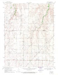
1969 Map of Beaver
USGS Topo · Published 1971About this map
Oil and gas development dominates the rolling landscape of the Barton and Russell county line, where numerous named production fields blanket the terrain. The community of Beaver serves as a small central hub, situated along the tracks of the Atchison Topeka and Santa Fe railroad. This industrial infrastructure is layered over a rural layout defined by section lines and local landmarks, including several burial grounds such as St Josephs Cem, Presbyterian Cem, and Friends Cem.
Find a feature on this map
18 named features on this map. Tap any name to fly to it.
Don’t see what you’re looking for? This feature index may not catch every label — zoom into the map to look around manually.
Map Details
Editions of this 1969 Beaver Map
This is the sole edition of this map. No revisions or reprints were ever made.
Other maps of this area

1896 · Russell
USGS Topo · 1:125,000

1955 · Great Bend
USGS Topo · 1:250,000

1956 · Dorrance
USGS Topo · 1:24,000

1956 · Dorrance SW
USGS Topo · 1:24,000

1957 · Great Bend
USGS Topo · 1:250,000

1958 · Great Bend
USGS Topo · 1:250,000

1961 · Homer
USGS Topo · 1:24,000
1969 · Claflin
USGS Topo · 1:24,000
1969 · Redwing
USGS Topo · 1:24,000
1969 · Hoisington
USGS Topo · 1:24,000