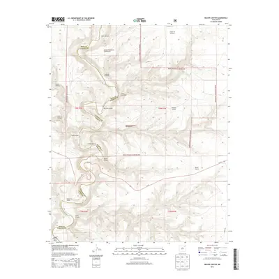
2013 Map of Beaver Canyon
USGS Topo · Published 2013About this map
The Kiowa National Grassland dominates this landscape along the border of Harding and Mora Counties, where the high plains break into a complex system of drainages. The Canadian River snakes through the southwest corner, carving deep relief into the terrain at Upper Horseshoe Bend and Cañon Alamita. This territory is defined by its deep canyons, with Beaver Canyon and Whitman Canyon cutting eastward toward the river valley. The map reveals the intricate network of traditional Spanish-named landforms such as Cañon Mesteño, Cañon Hondo, and Cañon Blanco. While human infrastructure is sparse, the presence of NM-120 and cattle-country routes like CO Road T-4 provide the primary access to this expansive section of northeastern New Mexico.
Find a feature on this map
24 named features on this map. Tap any name to fly to it.
Don’t see what you’re looking for? This feature index may not catch every label — zoom into the map to look around manually.
Map Details
Editions of this 2013 Beaver Canyon Map
This is the sole edition of this map. No revisions or reprints were ever made.
Other maps of this area

1954 · Santa Fe
USGS Topo · 1:250,000

1954 · Raton
USGS Topo · 1:250,000

1958 · Raton
USGS Topo · 1:250,000

1958 · Santa Fe
USGS Topo · 1:250,000

1971 · Beaver Canyon
USGS Topo · 1:24,000

1971 · Alamito
USGS Topo · 1:24,000

1971 · Canon Las Cuevas
USGS Topo · 1:24,000

1971 · Canon Encierro
USGS Topo · 1:24,000

1972 · Canon Colorado
USGS Topo · 1:24,000

1972 · Mills West
USGS Topo · 1:24,000