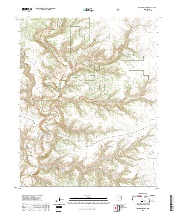
2023 Map of Beaver Canyon
USGS Topo · Published 2023About this map
The Kiowa National Grassland dominates this corner of Northeast New Mexico, where the plains are deeply incised by complex canyon systems. The Canadian River cuts through the northwest corner near the Mora and Harding County line, serving as the primary drainage for numerous tributary cañons. The map details a labyrinthine topography including Beaver Canyon, Cañon Blanco, and Whitman Canyon, illustrating the high-desert erosion patterns typical of this region. While the landscape is largely defined by these natural features, the presence of Co Rd T-4 and Salamon Rd suggests the sparse ranching or conservation access routes that navigate the mesa tops. This document provides a clear look at the intricate relief of Cañon de la Cueva and Cañon Alamita, where the transition from flat grassland to steep canyon walls is most pronounced.
Find a feature on this map
20 named features on this map. Tap any name to fly to it.
Don’t see what you’re looking for? This feature index may not catch every label — zoom into the map to look around manually.
Map Details
Editions of this 2023 Beaver Canyon Map
This is the sole edition of this map. No revisions or reprints were ever made.
Other maps of this area

1954 · Santa Fe
USGS Topo · 1:250,000

1954 · Raton
USGS Topo · 1:250,000

1958 · Raton
USGS Topo · 1:250,000

1958 · Santa Fe
USGS Topo · 1:250,000

1971 · Beaver Canyon
USGS Topo · 1:24,000

1971 · Alamito
USGS Topo · 1:24,000

1971 · Canon Las Cuevas
USGS Topo · 1:24,000

1971 · Canon Encierro
USGS Topo · 1:24,000

1972 · Canon Colorado
USGS Topo · 1:24,000

1972 · Mills West
USGS Topo · 1:24,000