
1971 Map of Beaver Canyon
USGS Topo · Published 1975About this map
The Canadian River carves a deep, winding path through the high plains along the border of Mora and Harding counties. This remote landscape is defined by an intricate network of drainage systems, including Beaver Canyon and Cañon Blanco, which feed into the primary river valley. Access during this era was limited to a complex system of Jeep Trails that traverse the high mesas and descend into the canyons. At the southern end of the sheet, the river performs a dramatic maneuver at Upper Horseshoe Bend, highlighting the erosive power of the water against the local geology. Evidence of early settlement and the isolation of the area is found in the small Cem located near a sharp bend in the river, as well as several gravesites scattered along the rugged canyon floors such as Cañon Whitman and Cañon Los Paises.
Find a feature on this map
19 named features on this map. Tap any name to fly to it.
Don’t see what you’re looking for? This feature index may not catch every label — zoom into the map to look around manually.
Map Details
Editions of this 1971 Beaver Canyon Map
This is the sole edition of this map. No revisions or reprints were ever made.
Other maps of this area

1954 · Santa Fe
USGS Topo · 1:250,000

1954 · Raton
USGS Topo · 1:250,000

1958 · Raton
USGS Topo · 1:250,000

1958 · Santa Fe
USGS Topo · 1:250,000

1971 · Alamito
USGS Topo · 1:24,000

1971 · Canon Las Cuevas
USGS Topo · 1:24,000

1971 · Canon Encierro
USGS Topo · 1:24,000

1972 · Canon Colorado
USGS Topo · 1:24,000

1972 · Mills West
USGS Topo · 1:24,000
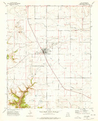
1974 · Roy
USGS Topo · 1:24,000