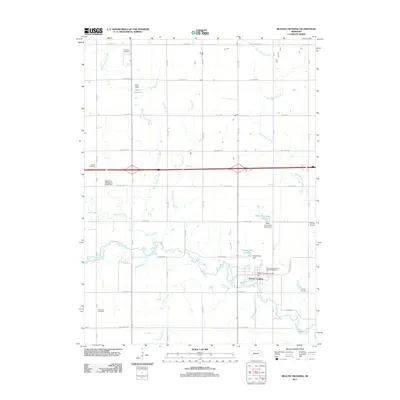
2011 Map of Beaver Crossing
USGS Topo · Published 2011About this map
The West Fork Big Blue River carves a winding path across this Seward County landscape, centering on the village of Beaver Crossing. This 2011 survey documents a community defined by its water resources and agricultural infrastructure, featuring several significant water management structures like the Brackhan-Marquardt Road Dam, Langworthy Dam, and Miller Dam. These dams support local reservoirs including Miller-Flowerday Reservoir and Langworthy Reservoir, which are vital to the irrigation and conservation efforts in this Nebraska river valley.
Find a feature on this map
40 named features on this map. Tap any name to fly to it.
Don’t see what you’re looking for? This feature index may not catch every label — zoom into the map to look around manually.
Map Details
Editions of this 2011 Beaver Crossing Map
This is the sole edition of this map. No revisions or reprints were ever made.
Other maps of this area

1934 · Seward
USGS Topo · 1:48,000

1934 · Utica
USGS Topo · 1:62,500

1935 · Dorchester
USGS Topo · 1:48,000

1937 · Utica
USGS Topo · 1:62,500

1939 · Seward
USGS Topo · 1:62,500

1940 · Dorchester
USGS Topo · 1:62,500

1955 · Lincoln
USGS Topo · 1:250,000

1957 · Lincoln
USGS Topo · 1:250,000

1958 · Lincoln
USGS Topo · 1:250,000
1964 · Staplehurst
USGS Topo · 1:24,000