
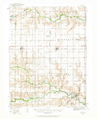
1934 Map of Utica
USGS Topo · Published 1961About this map
Utica and Beaver Crossing anchor this 1934 survey of the Nebraska plains, where the transition from York to Seward County is defined by a dense network of rural school districts and winding creek bottoms. The landscape is structured by the Chicago Burlington and Quincy and the Chicago and Northwestern railroads, which parallel early transit corridors like State Highway No 2. A high density of country schools, including Sleepy Hollow Sch, Midget Sch, and Rosemond Sch, reflects a deeply settled agrarian community before mid-century school consolidations. Along the West Fork Big Blue River, specific landmarks like the K of P Camp and the Flowing Well suggest a more social and recreational side to the valley, while cemeteries such as Prairie Grove Cem and Cashier Cem offer vital markers for genealogical research.
Find a feature on this map
57 named features on this map. Tap any name to fly to it.
Don’t see what you’re looking for? This feature index may not catch every label — zoom into the map to look around manually.
Map Details
Editions of this 1934 Utica Map
2 editions found
Other maps of this area

1896 · Stromsburg
USGS Topo · 1:125,000

1898 · York
USGS Topo · 1:125,000

1899 · David City
USGS Topo · 1:125,000

1899 · York
USGS Topo · 1:125,000

1934 · Seward
USGS Topo · 1:48,000

1935 · Dorchester
USGS Topo · 1:48,000

1937 · Utica
USGS Topo · 1:62,500

1939 · Seward
USGS Topo · 1:62,500

1940 · Dorchester
USGS Topo · 1:62,500

1955 · Fremont
USGS Topo · 1:250,000