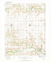
1934 Map of Utica
USGS Topo · Published 1966About this map
Utica and Beaver Crossing anchor this mid-1930s Nebraska landscape, where the agricultural grid is defined by a dense network of country schoolhouses. Educational life once centered on named institutions like Abraham Sch, Flowing Well Sch, and Sleepy Hollow Sch, which dotted the townships at nearly every mile. The Chicago And Northwestern and Chicago Burlington And Quincy railroads provide the primary east-west arteries, connecting grain elevators and small-town depots from Waco to Thayer.
Find a feature on this map
64 named features on this map. Tap any name to fly to it.
Don’t see what you’re looking for? This feature index may not catch every label — zoom into the map to look around manually.
Map Details
Editions of this 1934 Utica Map
2 editions found
Other maps of this area

1896 · Stromsburg
USGS Topo · 1:125,000

1898 · York
USGS Topo · 1:125,000

1899 · David City
USGS Topo · 1:125,000

1899 · York
USGS Topo · 1:125,000

1934 · Seward
USGS Topo · 1:48,000

1934 · Utica
USGS Topo · 1:62,500

1935 · Dorchester
USGS Topo · 1:48,000

1937 · Utica
USGS Topo · 1:62,500

1939 · Seward
USGS Topo · 1:62,500

1940 · Dorchester
USGS Topo · 1:62,500