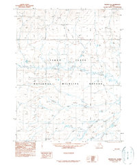
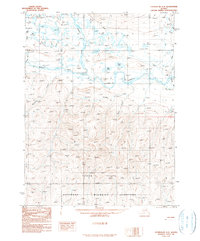
1990 Map of Beaver D-2
USGS Topo · Published 1990About this map
Yukon Flats dominate this landscape, showing a complex network of seasonal water and low-lying terrain within the National Wildlife Refuge. The map identifies rare geological formations known as Pingos, which are ice-cored mounds common in permafrost regions. Human presence is marked by isolated outposts like Fiftysix Mile Cabin and Fortysix Mile Cabin, connected by a long Winter Trail that cuts north-to-south across the Fairbanks Meridian. These cabins and named water bodies such as the Hadweenzic River and Fortymile Lake reflect the subsistence and transit patterns of the Alaskan interior during the late 20th century. The intricate drainage system, including Fortytwo Mile Creek and Forty and One-half Mile Creek, underscores the reliance on specific landmarks for navigation in a region without a permanent road network.
Find a feature on this map
12 named features on this map. Tap any name to fly to it.
Don’t see what you’re looking for? This feature index may not catch every label — zoom into the map to look around manually.
Map Details
Editions of this 1990 Beaver D-2 Map
This is the sole edition of this map. No revisions or reprints were ever made.
Other maps of this area

1951 · Chandalar
USGS Topo · 1:250,000

1951 · Beaver
USGS Topo · 1:250,000

1956 · Chandalar
USGS Topo · 1:250,000

1956 · Beaver
USGS Topo · 1:250,000

1964 · Chandalar
USGS Topo · 1:250,000

1964 · Beaver
USGS Topo · 1:250,000
1990 · Chandalar A-2
USGS Topo · 1:63,360
1990 · Chandalar A-1
USGS Topo · 1:63,360
1990 · Beaver C-2
USGS Topo · 1:63,360
1990 · Chandalar A-3
USGS Topo · 1:63,360