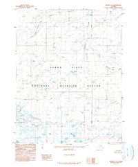
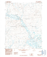
1990 Map of Beaver C-2
USGS Topo · Published 1990About this map
Yukon Flats dominate this subarctic landscape within the Yukon Flats National Wildlife Refuge, where a dense network of lakes and seasonal wetlands reveals the complex hydrology of the northern interior. The map captures the region as it was documented from aerial photography in the late 1970s and early 1980s, showing a terrain shaped by the Hodzana River and numerous water bodies including Howard Lake, Adam Lake, and Nelson Lake. These features are set against the prominent elevation of Twentynine Mile Ridge and the drainages of Fortymile Creek and the curiously named Forty-one-half Mile Creek. The placement of the Fairbanks Meridian through this wilderness serves as a critical reference for a territory defined more by its natural waterways and ridges than by human settlement.
Find a feature on this map
11 named features on this map. Tap any name to fly to it.
Don’t see what you’re looking for? This feature index may not catch every label — zoom into the map to look around manually.
Map Details
Editions of this 1990 Beaver C-2 Map
This is the sole edition of this map. No revisions or reprints were ever made.
Other maps of this area

1951 · Beaver
USGS Topo · 1:250,000

1956 · Beaver B-2
USGS Topo · 1:63,360

1956 · Beaver B-3
USGS Topo · 1:63,360

1956 · Beaver
USGS Topo · 1:250,000

1956 · Beaver B-1
USGS Topo · 1:63,360

1964 · Beaver
USGS Topo · 1:250,000
1990 · Beaver D-2
USGS Topo · 1:63,360
1990 · Beaver D-1
USGS Topo · 1:63,360
1990 · Beaver C-1
USGS Topo · 1:63,360
1990 · Beaver C-3
USGS Topo · 1:63,360