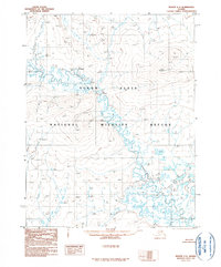
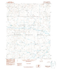
1990 Map of Beaver C-3
USGS Topo · Published 1990About this map
Yukon Flats National Wildlife Refuge encompasses a complex aquatic landscape in this interior Alaskan wilderness as it was documented in the late 1970s and 1990. The Hodzana River snakes through the low-lying Yukon Flats, creating a maze of oxbows and sloughs including the distinctive passage at The Narrows. To the north and west, the terrain rises toward Nelson Mountain and Middle, contrasting with the saturated floodplains below.
Find a feature on this map
12 named features on this map. Tap any name to fly to it.
Don’t see what you’re looking for? This feature index may not catch every label — zoom into the map to look around manually.
Map Details
Editions of this 1990 Beaver C-3 Map
This is the sole edition of this map. No revisions or reprints were ever made.
Other maps of this area

1951 · Beaver
USGS Topo · 1:250,000

1956 · Beaver B-2
USGS Topo · 1:63,360

1956 · Beaver B-3
USGS Topo · 1:63,360

1956 · Beaver
USGS Topo · 1:250,000

1956 · Beaver B-4
USGS Topo · 1:63,360

1964 · Beaver
USGS Topo · 1:250,000
1970 · Beaver D-4
USGS Topo · 1:63,360
1970 · Beaver C-4
USGS Topo · 1:63,360
1990 · Beaver C-2
USGS Topo · 1:63,360
1990 · Beaver D-2
USGS Topo · 1:63,360