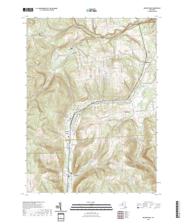
2023 Map of Beaver Dams
USGS Topo · Published 2023About this map
Beaver Dams and the surrounding rural uplands of Schuyler County define this landscape, where steep hollows and high ridges dictate the local road network. The northeastern corner of the map is dominated by the Watkins Glen Int'l Race Track, a major regional landmark situated just south of Watkins Hill. For genealogists and local historians, the sheet is exceptionally well-annotated with small burial grounds, including Sugar Hill Cem, Cooley Cem, and the Savory Cem. High-elevation landmarks like Sugar Hill and Baker Hill rise above winding creeks such as Shequaga Creek and Townsend Creek. The presence of the North Country National Scenic Trail through the northern hills highlights the area's transition toward recreation, while small settlements like Townsend, Moreland, and Chambers maintain the traditional settlement patterns of this part of New York's Southern Tier.
Find a feature on this map
65 named features on this map. Tap any name to fly to it.
Don’t see what you’re looking for? This feature index may not catch every label — zoom into the map to look around manually.
Map Details
Editions of this 2023 Beaver Dams Map
This is the sole edition of this map. No revisions or reprints were ever made.
Other maps of this area

1895 · Elmira
USGS Topo · 1:62,500

1898 · Watkins Glen
USGS Topo · 1:62,500

1901 · Watkins
USGS Topo · 1:62,500

1903 · Hammondsport
USGS Topo · 1:62,500

1905 · Watkins Glen
USGS Topo · 1:125,000

1914 · Corning
USGS Topo · 1:62,500

1944 · Corning
USGS Topo · 1:62,500

1950 · Elmira
USGS Topo · 1:250,000
1950 · Burdett
USGS Topo · 1:24,000

1950 · Montour Falls
USGS Topo · 1:24,000