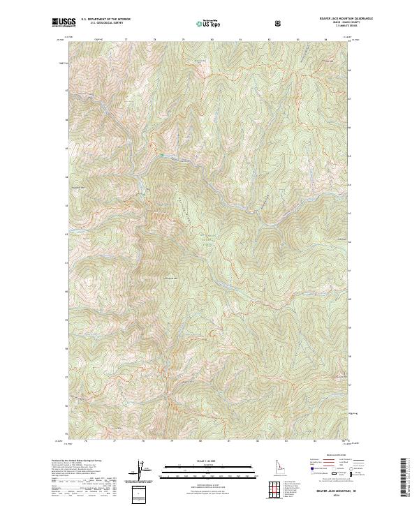
2024 Map of Beaver Jack Mountain
USGS Topo · Published 2024About this map
The Middle Fork Clearwater Wild and Scenic River carves through the heart of this high-elevation backcountry, serving as a boundary for some of the nation's most protected lands. This landscape is a meeting point for the Selway-Bitterroot Wilderness to the north and the Frank Church-River of No Return Wilderness to the south. Historically significant travel ways, including the Magruder Corridor Rd and the Nez Perce Indian Trl, trace the ridgelines and creek beds.
Find a feature on this map
41 named features on this map. Tap any name to fly to it.
Don’t see what you’re looking for? This feature index may not catch every label — zoom into the map to look around manually.
Map Details
Editions of this 2024 Beaver Jack Mountain Map
This is the sole edition of this map. No revisions or reprints were ever made.
Other maps of this area

1956 · Elk City
USGS Topo · 1:250,000

1960 · Elk City
USGS Topo · 1:250,000

1962 · Wood Hump
USGS Topo · 1:24,000

1962 · Beaver Jack Mtn
USGS Topo · 1:24,000

1962 · Blue Joint
USGS Topo · 1:24,000

1962 · Nez Perce Peak
USGS Topo · 1:24,000

1966 · Watchtower Peak
USGS Topo · 1:24,000

1966 · Spot Mountain
USGS Topo · 1:24,000
1966 · Burnt Strip Mtn
USGS Topo · 1:24,000

1978 · Magruder Mtn
USGS Topo · 1:24,000