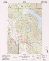
1994 Map of Beaver Lake
USGS Topo · Published 1997About this map
Stillwater State Forest and the Flathead National Forest dominate this northwest Montana landscape, where timbered slopes meet a dense network of alpine lakes and glacial drainages. The Burlington Northern railroad serves as the primary industrial artery, following the westward bend of the Stillwater River before piercing the terrain at the Vista Tunnel. This corridor connects small trackside points like Benson and Vista with the broader regional economy.
Find a feature on this map
48 named features on this map. Tap any name to fly to it.
Don’t see what you’re looking for? This feature index may not catch every label — zoom into the map to look around manually.
Map Details
Editions of this 1994 Beaver Lake Map
2 editions found
Other maps of this area

1906 · Kintla Lakes
USGS Topo · 1:125,000

1913 · Stryker
USGS Topo · 1:125,000

1916 · Stryker
USGS Topo · 1:125,000

1938 · Kintla Lakes
USGS Topo · 1:125,000

1943 · Kalispell
USGS Topo · 1:125,000

1957 · Kalispell
USGS Topo · 1:250,000

1960 · Kalispell
USGS Topo · 1:250,000

1961 · Kalispell
USGS Topo · 1:250,000

1962 · Rose Crossing
USGS Topo · 1:24,000

1962 · Beaver Lake
USGS Topo · 1:24,000