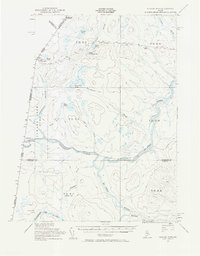
1955 Map of Beaver Pond
USGS Topo · Published 1969About this map
The Canada United States border defines the northwestern edge of this wilderness survey, where the international boundary separates Quebec from the northern reaches of Maine. The St John River and its major tributaries, including the Northwest Branch St John River and Southwest Branch St John River, dictate the movement through this densely forested and pond-heavy landscape. Small cross-border settlements like Lac Frontiere and Daaquam appear near the line, supported by a dedicated Customs Office that underscores the importance of the border crossing in this remote region.
Find a feature on this map
37 named features on this map. Tap any name to fly to it.
Don’t see what you’re looking for? This feature index may not catch every label — zoom into the map to look around manually.
Map Details
Editions of this 1955 Beaver Pond Map
3 editions found
Other maps of this area

1954 · Baker Lake
USGS Topo · 1:62,500

1954 · Allagash Lake
USGS Topo · 1:62,500

1954 · Presque Isle
USGS Topo · 1:250,000

1955 · Depot Lake
USGS Topo · 1:62,500

1955 · Beaver Pond
USGS Topo · 1:62,500

1955 · Clayton Lake
USGS Topo · 1:62,500

1955 · Seven Islands
USGS Topo · 1:62,500

1957 · Hardwood Mountain
USGS Topo · 1:62,500

1958 · Presque Isle
USGS Topo · 1:250,000

1960 · Presque Isle
USGS Topo · 1:250,000