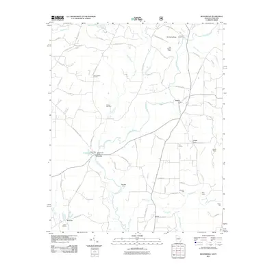
2011 Map of Beaverdale
USGS Topo · Published 2011About this map
The Conasauga River meanders through this agricultural and riverine landscape on the Georgia-Tennessee border, anchoring a series of small settlements and family landmarks. In the northern reaches, Gregorys Mill and Gregory sit near the river’s bend, while Upper Kings Bridge provides a vital crossing point just south of Beaverdale. The terrain is defined by low ridges and valleys, including Gap Spring Ridge and Sumac Ridge, which hem in the fertile plains where Sugar Creek and Sumac Creek flow. Genealogy researchers can find several established burial grounds, such as Mount Pleasant Cemetery and Shields Harris Cemetery, providing clear evidence of generational residence in communities like Ruralvale and Temple Grove. The map also identifies local landmarks like Hampton Island and Blue Bird Field, reflecting a rural character where land use is intimately tied to the waterways and surrounding valleys such as Fairy Valley.
Find a feature on this map
83 named features on this map. Tap any name to fly to it.
Don’t see what you’re looking for? This feature index may not catch every label — zoom into the map to look around manually.
Map Details
Editions of this 2011 Beaverdale Map
This is the sole edition of this map. No revisions or reprints were ever made.
Other maps of this area

1886 · Dalton
USGS Topo · 1:125,000

1886 · Cleveland
USGS Topo · 1:125,000

1892 · Cleveland
USGS Topo · 1:125,000

1892 · Dalton
USGS Topo · 1:125,000

1895 · Cleveland
USGS Topo · 1:125,000

1897 · Dalton
USGS Topo · 1:125,000

1901 · Cleveland
USGS Topo · 1:125,000

1911 · Cohutta Mtn
USGS Topo · 1:62,500

1913 · Cohutta Mtn.
USGS Topo · 1:62,500

1935 · Mc Donald
USGS Topo · 1:24,000