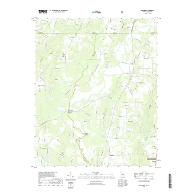
2020 Map of Beaverdale
USGS Topo · Published 2020About this map
Conasauga River meanders across the border of Georgia and Tennessee, creating a complex network of wetlands and rural settlements at the intersection of Whitfield and Murray counties. This area is characterized by scattered communities such as Beaverdale and Gregory, connected by long-established routes like Prater Mill Rd NE and Beaverdale Rd. The presence of the Upper Kings Bridge and Hampton Island highlights the river's historical role as a central landmark for local transport and property lines.
Find a feature on this map
117 named features on this map. Tap any name to fly to it.
Don’t see what you’re looking for? This feature index may not catch every label — zoom into the map to look around manually.
Map Details
Editions of this 2020 Beaverdale Map
This is the sole edition of this map. No revisions or reprints were ever made.
Other maps of this area

1886 · Dalton
USGS Topo · 1:125,000

1886 · Cleveland
USGS Topo · 1:125,000

1892 · Cleveland
USGS Topo · 1:125,000

1892 · Dalton
USGS Topo · 1:125,000

1895 · Cleveland
USGS Topo · 1:125,000

1897 · Dalton
USGS Topo · 1:125,000

1901 · Cleveland
USGS Topo · 1:125,000

1911 · Cohutta Mtn
USGS Topo · 1:62,500

1913 · Cohutta Mtn.
USGS Topo · 1:62,500

1935 · Mc Donald
USGS Topo · 1:24,000