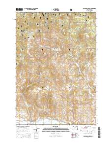
2014 Map of Beaverdam Creek
USGS Topo · Published 2014About this map
Whitman National Forest dominates this high-country landscape in Baker County, where the transition from timbered slopes to valley floor is defined by a network of essential water rights. Near the southern edge, the settlement of Hereford sits along the Burnt River, serving as a hub for the surrounding ranching and agricultural operations. The importance of water management in this arid region is visible through the engineering of the Hereford Ditch, Cook Ditch, and Cleary Ditch, which divert mountain runoff to the plains below.
Find a feature on this map
53 named features on this map. Tap any name to fly to it.
Don’t see what you’re looking for? This feature index may not catch every label — zoom into the map to look around manually.
Map Details
Editions of this 2014 Beaverdam Creek Map
This is the sole edition of this map. No revisions or reprints were ever made.
Other maps of this area

1901 · Baker City
USGS Topo · 1:125,000

1901 · Sumpter
USGS Topo · 1:125,000

1908 · Ironside Mountain
USGS Topo · 1:125,000

1955 · Baker
USGS Topo · 1:250,000

1955 · Canyon City
USGS Topo · 1:250,000

1959 · Baker
USGS Topo · 1:250,000

1959 · Canyon City
USGS Topo · 1:250,000

1964 · Ironside
USGS Topo · 1:62,500

1967 · Blue Canyon
USGS Topo · 1:24,000
1967 · Brannan Gulch
USGS Topo · 1:24,000