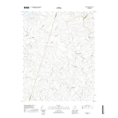
2019 Map of Beaverdam
USGS Topo · Published 2019About this map
The North Anna River and the expansive shoreline of Lake Anna define the northern reaches of this central Virginia landscape. This modern survey illustrates the transition from the lakeside recreation area near Bumpass to the more traditional rural crossroads that characterize the region's interior. Settlements like Beaverdam, Tylers, and the interestingly named Old Bandana represent the historical focal points for local communities. The terrain is deeply etched by a network of watercourses, including the Little River and Hollowing Cr, which have historically dictated road patterns and land use. For researchers, the map provides precise locations for rural landmarks such as Terrell Store and Anderson Bridge, alongside specialized infrastructure like the Lake Anna Airport, highlighting the region's mix of traditional agriculture and contemporary development.
Find a feature on this map
98 named features on this map. Tap any name to fly to it.
Don’t see what you’re looking for? This feature index may not catch every label — zoom into the map to look around manually.
Map Details
Editions of this 2019 Beaverdam Map
This is the sole edition of this map. No revisions or reprints were ever made.
Other maps of this area

1887 · Spottsylvania
USGS Topo · 1:125,000

1890 · Goochland
USGS Topo · 1:125,000

1892 · Spottsylvania
USGS Topo · 1:125,000

1892 · Goochland
USGS Topo · 1:125,000

1942 · Ladysmith
USGS Topo · 1:31,680

1942 · Partlow
USGS Topo · 1:31,680

1942 · Contrary Creek
USGS Topo · 1:31,680

1942 · Buckner
USGS Topo · 1:24,000

1942 · Beaverdam
USGS Topo · 1:24,000

1943 · Mabelton
USGS Topo · 1:31,680