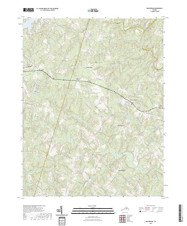
2022 Map of Beaverdam
USGS Topo · Published 2022About this map
Beaverdam serves as the focal point for this landscape where the boundaries of Hanover, Louisa, Caroline, and Spotsylvania counties converge. The modern CSX rail line traces a historic transit path through the region, connecting rural crossroads like Tylers and Green Bay with larger regional networks. Significant water features define the local geography, from the expansive Lake Anna in the northwest to the winding courses of the Little River and North Anna River. This area is characterized by a mix of traditional settlement names like Old Bandana and Terrell Store alongside 21st-century infrastructure such as the Lake Anna Airport. The abundance of swampy lowlands, including Pug Swamp and Jones Swamp, illustrates the natural drainage patterns that have historically influenced road placement and land use across this part of central Virginia.
Find a feature on this map
101 named features on this map. Tap any name to fly to it.
Don’t see what you’re looking for? This feature index may not catch every label — zoom into the map to look around manually.
Map Details
Editions of this 2022 Beaverdam Map
This is the sole edition of this map. No revisions or reprints were ever made.
Other maps of this area

1887 · Spottsylvania
USGS Topo · 1:125,000

1890 · Goochland
USGS Topo · 1:125,000

1892 · Spottsylvania
USGS Topo · 1:125,000

1892 · Goochland
USGS Topo · 1:125,000

1942 · Ladysmith
USGS Topo · 1:31,680

1942 · Partlow
USGS Topo · 1:31,680

1942 · Contrary Creek
USGS Topo · 1:31,680

1942 · Buckner
USGS Topo · 1:24,000

1942 · Beaverdam
USGS Topo · 1:24,000

1943 · Mabelton
USGS Topo · 1:31,680