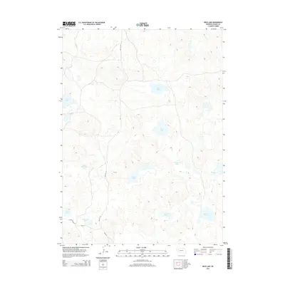
2014 Map of Beck Lake
USGS Topo · Published 2014About this map
The alkaline lake country of Nebraska's Sandhills is depicted here in detail, showing a landscape defined by isolated water bodies and depressions. Large, shallow basins such as Beck Lake and Hills Lake dominate the central terrain, while the naming of Homestead Lake and School Section Lake points to the early 20th-century history of public land distribution and pioneer settlement in Garden County. The terrain is sparsely developed, with a rudimentary grid represented by Road No 155 and Road 124 providing the only clear terrestrial navigation between the numerous water bodies like Old Merrill Lake and Jordan Lake. This 2014 survey documents the persistence of these hydrologic features in a high-plains environment where water was the primary driver of both settlement and ranching boundaries.
Find a feature on this map
14 named features on this map. Tap any name to fly to it.
Don’t see what you’re looking for? This feature index may not catch every label — zoom into the map to look around manually.
Map Details
Editions of this 2014 Beck Lake Map
This is the sole edition of this map. No revisions or reprints were ever made.
Other maps of this area

1896 · Browns Creek
USGS Topo · 1:125,000

1899 · Browns Creek
USGS Topo · 1:125,000

1948 · Antioch
USGS Topo · 1:62,500

1948 · Lakeside
USGS Topo · 1:62,500

1949 · Mumper
USGS Topo · 1:62,500

1949 · Antioch
USGS Topo · 1:62,500

1950 · Storm Lake
USGS Topo · 1:62,500

1950 · Lakeside
USGS Topo · 1:62,500

1954 · Scottsbluff
USGS Topo · 1:250,000

1955 · Alliance
USGS Topo · 1:250,000