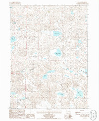
1986 Map of Beck Lake
USGS Topo · Published 1986About this map
Sandhill lake country in western Nebraska is the defining characteristic of this mid-1980s provisional survey. The landscape is dominated by a complex network of shallow basins and ponds, such as Beck Lake and Hills Lake, which appear as distinct depressions among the dunes. This geography shaped the ranching economy of the region, evident in the presence of the Mule Shoe Bar Ranch located near the southern boundary. The distribution of water sources like Homestead Lake and School Section Lake suggests a reliance on specific land parcels for grazing and livestock management within the expansive Garden County terrain. Researchers of Nebraska ranching history can trace the relationship between these seasonal or permanent water bodies, such as Jordan Lake and Merrill Lake, and the isolated ranching outposts that managed this unique prairie ecosystem during the late twentieth century.
Find a feature on this map
13 named features on this map. Tap any name to fly to it.
Don’t see what you’re looking for? This feature index may not catch every label — zoom into the map to look around manually.
Map Details
Editions of this 1986 Beck Lake Map
This is the sole edition of this map. No revisions or reprints were ever made.
Other maps of this area

1896 · Browns Creek
USGS Topo · 1:125,000

1899 · Browns Creek
USGS Topo · 1:125,000

1948 · Antioch
USGS Topo · 1:62,500

1948 · Lakeside
USGS Topo · 1:62,500

1949 · Mumper
USGS Topo · 1:62,500

1949 · Antioch
USGS Topo · 1:62,500

1950 · Storm Lake
USGS Topo · 1:62,500

1950 · Lakeside
USGS Topo · 1:62,500

1954 · Scottsbluff
USGS Topo · 1:250,000

1955 · Alliance
USGS Topo · 1:250,000